There will be some surprising winter weather on the way for Southern Ontario. A complicated low pressure system will arrive in Southern Ontario overnight. Rain will be the main precipitation with this storm; however, the backdrop of the storm will only be snow. The snow will arrive on Friday along with brisk cold winds. Zero visibility in blowing snow will make driving hazardous.
Outside of snow squalls, Southern Ontario can expect a general snow amount of 5-10 centimeters. If you are one of those unfortunate people inside a snowsquall, you can expect up to 40 centimeters of snow between Friday and Sunday morning. Please monitor the watches and warning box on the right side of this webpage for the latest information on this developing story.
Cold Snap Coming

Next Thursday will be a turning point in the weather as mild temperatures will be replaced with cold biting temperatures. There is uncertianty about whether a winter storm will lead that change, or if it will be led by a rainy event for Southern Ontario. The weather models are extremely unpredictable this far out. Currently, the GFS has the low pressure system further east than the GGEM and ECMWF, but that will probably change. I will post further updates in the next couple of days.
As for now, we have a small cold front crossing the midwest into Southern Ontario. It shouldn't cause the temperatures to dip too significantly. Like I mentioned earlier, the real temperature change will arrive sometime later next week.
Weekend Storm Maps
UPDATE
THE EXACT TRACK OF THIS STORM HAS BECOME MORE CLEAR. WINTER STORM WARNINGS AND WATCHES ALONG WITH FREEZING RAIN WARNINGS HAVE BEEN ISSUED FOR DIFFERENT AREAS OF SOUTHERN ONTARIO. PLEASE CLICK YOUR REGION ON THE MAP BELOW MY ARTICLE FOR FURTHER INFORMATION ON YOUR SPECIFIC WEATHER ALERT. I AM NOW RELEASING SNOWFALL PREDICTIONS FOR DIFFERENT CITIES BASED ON ENVIRONMENT CANADA DATA AS WELL AS MY OWN.
TORONTO - 5-7 CENTIMETERS
HAMILTON - 5-7 CENTIMETERS
BURLINGTON - 5-7 CENTIMETERS
MISSISAUGA - 5-7 CENTIMETERS
BRAMPTON - 8-15 CENTIMETERS
NEWMARKET - 15-18 CENTIMETERS
BARRIE - 25-35 CENTIMETERS
ORANGEVILLE - 15-25 CENTIMETERS
KITCHENER - 10-15 CENTIMETERS
PERRYSOUND - 25-35 CENTIMETERS
GODERICH - 25-35 CENTIMETERS
SARNIA - 20-30 CENTIMETERS
STRATFORD - 15-20 CENTIMETERS
COLLINGWOOD - 25-35 CENTIMETERS
PLEASE NOTE THAT THESE PREDICTIONS DO NOT INCLUDE SLEET AND FREEZING RAIN WHICH IS EXPECTED TO AFFECT AREAS ALONG LAKE ERIE AND LAKE ONTARIO. THESE SNOWFALL TOTALS ARE NOT INCLUDED IN THE LAKE EFFECT SNOW EVENT WHICH IS EXPECTED TO START UP ON MONDAY. THE AREAS BETWEEN HAMILTON AND TORONTO ARE EXPECTED TO RECIEVE LESS SNOW BECAUSE OF ANTICIPATED DRY SLOT.


It has been a long wait for snow lovers, but this weekend might be their big break. A low pressure system from the west is expected to trek eastward towards Southern Ontario, bringing a mixed bag of precipitation for some, and a snow event for others. A secondary low along the east coast is also expected to form and join up with the first low. Both systems are expected to spread a fair amount of precipitation into the Great Lakes and Midwest. The exact track of this system is still uncertain and things could change slightly within the next 24 hours, however we do have a better idea of the storm track as the weather models become more consistent in their way of thinking. Current indications do show us that the storm system will reach Southwestern Ontario by late Saturday night, and then reach Toronto by Sunday morning.
I put together a snow map for Southern Ontario based on data from Environment Canada. South of a line from Sarnia to Vaughn, and then to Cobourg, you can expect a mixed event consisting of rain and snow. North of a line from Sarnia to Vaughn, and then Cobourg, you can expect mostly snow. I did not include areas around Kingston and Ottawa in the snow map above, because I am expecting mostly rain for these areas with a brief changeover to snow. A general snow amount of 5 - 6 centimeters is not unlikely south of a line from Cobourg to Renfrew, which would include Kingston and Ottawa. Environment Canada is expected to issue warnings or watches for key areas in Southern Ontario during the next 24 - 36 hours.
The storm is expected to end for most of Southern Ontario by late Sunday night or early Monday morning. Shortly after this storm departs, we will see cold air sweep into Southern Ontario. Strong winds will develop and create zero visibility for a lot of different areas. Snowsqualls will also develop and possibly contribute another three feet of snow to snowbelt regions. I will update you as soon as I get more information on the track and timing of this storm as well as the snowsquall event.
THE EXACT TRACK OF THIS STORM HAS BECOME MORE CLEAR. WINTER STORM WARNINGS AND WATCHES ALONG WITH FREEZING RAIN WARNINGS HAVE BEEN ISSUED FOR DIFFERENT AREAS OF SOUTHERN ONTARIO. PLEASE CLICK YOUR REGION ON THE MAP BELOW MY ARTICLE FOR FURTHER INFORMATION ON YOUR SPECIFIC WEATHER ALERT. I AM NOW RELEASING SNOWFALL PREDICTIONS FOR DIFFERENT CITIES BASED ON ENVIRONMENT CANADA DATA AS WELL AS MY OWN.
TORONTO - 5-7 CENTIMETERS
HAMILTON - 5-7 CENTIMETERS
BURLINGTON - 5-7 CENTIMETERS
MISSISAUGA - 5-7 CENTIMETERS
BRAMPTON - 8-15 CENTIMETERS
NEWMARKET - 15-18 CENTIMETERS
BARRIE - 25-35 CENTIMETERS
ORANGEVILLE - 15-25 CENTIMETERS
KITCHENER - 10-15 CENTIMETERS
PERRYSOUND - 25-35 CENTIMETERS
GODERICH - 25-35 CENTIMETERS
SARNIA - 20-30 CENTIMETERS
STRATFORD - 15-20 CENTIMETERS
COLLINGWOOD - 25-35 CENTIMETERS
PLEASE NOTE THAT THESE PREDICTIONS DO NOT INCLUDE SLEET AND FREEZING RAIN WHICH IS EXPECTED TO AFFECT AREAS ALONG LAKE ERIE AND LAKE ONTARIO. THESE SNOWFALL TOTALS ARE NOT INCLUDED IN THE LAKE EFFECT SNOW EVENT WHICH IS EXPECTED TO START UP ON MONDAY. THE AREAS BETWEEN HAMILTON AND TORONTO ARE EXPECTED TO RECIEVE LESS SNOW BECAUSE OF ANTICIPATED DRY SLOT.


It has been a long wait for snow lovers, but this weekend might be their big break. A low pressure system from the west is expected to trek eastward towards Southern Ontario, bringing a mixed bag of precipitation for some, and a snow event for others. A secondary low along the east coast is also expected to form and join up with the first low. Both systems are expected to spread a fair amount of precipitation into the Great Lakes and Midwest. The exact track of this system is still uncertain and things could change slightly within the next 24 hours, however we do have a better idea of the storm track as the weather models become more consistent in their way of thinking. Current indications do show us that the storm system will reach Southwestern Ontario by late Saturday night, and then reach Toronto by Sunday morning.
I put together a snow map for Southern Ontario based on data from Environment Canada. South of a line from Sarnia to Vaughn, and then to Cobourg, you can expect a mixed event consisting of rain and snow. North of a line from Sarnia to Vaughn, and then Cobourg, you can expect mostly snow. I did not include areas around Kingston and Ottawa in the snow map above, because I am expecting mostly rain for these areas with a brief changeover to snow. A general snow amount of 5 - 6 centimeters is not unlikely south of a line from Cobourg to Renfrew, which would include Kingston and Ottawa. Environment Canada is expected to issue warnings or watches for key areas in Southern Ontario during the next 24 - 36 hours.
The storm is expected to end for most of Southern Ontario by late Sunday night or early Monday morning. Shortly after this storm departs, we will see cold air sweep into Southern Ontario. Strong winds will develop and create zero visibility for a lot of different areas. Snowsqualls will also develop and possibly contribute another three feet of snow to snowbelt regions. I will update you as soon as I get more information on the track and timing of this storm as well as the snowsquall event.
Weekend Storm Possibilities

Snowsqualls have dominated a lot of the weather discussions these past few days. Cities such as London, Barrie, Alliston, and Schomberg have been bombarded with snow amounts ranging from 30 - 80 centimeters in just 72 hours. The good news is that these snowsqualls will only weaken from this point forward. Local accumulations of 15 centimeters or more cannot be ruled out during the next 24 hours, and all residents are encouraged to check their local weather warnings and watches for further information regarding your specific information.
We have a clipper storm arriving from the west that will hit Southern Ontario sometime this Friday. The snowfall amounts will be in the 5-7 centimeter range and hardly noticeable as the storm lacks the much needed moisture to create sizable snow amounts.
The real talk seems to be focused on whether we get a winter storm this weekend. A possible winter storm could in fact travel through the Eastern Great Lakes spreading snow and wind into most of Southern Ontario. The GFS has this storm arriving early Sunday morning while the GEM has it arriving on Sunday afternoon. Most models show Southern Ontario to be a prime target for heavy snow with this storm, however things could change if the storm takes a more western approach. A more western track is not unlikely for this storm as one of the weather models so far has consistently held onto this idea. This would of course would substantially decrease snow amounts for Southern Ontario. If the storm track is through the Eastern Great Lakes, then a general snow amount of 6 - 8 inches of snow will definitely not be out of the question for places such as Toronto, Kingston, and Burlington. I will update you further as the time gets closer and more information becomes available.
Upcoming Storm (November 24 - 26)

I apologize for the delay in posting the details on this upcoming storm. Current radar shows this storm currently entering Windsor from the southwest. This storm will mostly be rain for Southern Ontario, however there is a substantial risk of freezing rain in the areas that I colored in pink. Environment Canada has also released the following weather statement in regards to this possibility:
"Special weather statement
Issued by Environment Canada Ontario region. 3:28 PM EST Wednesday
24 November 2010.
Special weather statement issued for..
Bancroft - Bon Echo Park
Brockville - Leeds and Grenville
City of Ottawa
Gatineau
Prescott and Russell
Cornwall - Morrisburg
Smiths Falls - Lanark - Sharbot Lake
Haliburton
Renfrew - Pembroke - Barry's Bay
Algonquin
Burk's Falls - Bayfield Inlet.
..Freezing rain is anticipated Thursday night..
A low pressure system over the central states will intensify and move
towards the upper Great Lakes. Light precipitation associated with
this system will enter Southwestern Ontario tonight and move
eastward. The weather system is expected to intensify over the
Upper Great Lakes Thursday night and bring freezing rain over the
above region.
Present indications are that freezing rain will begin in
Ottawa area late Thursday evening and may persist until Friday
morning.
Listen for further statements. Additional information may also be
found by consulting the latest public forecast. The next public
forecast will be issued by 3.30 PM."
-------------------------------------------------------------------------------------------------------------
The rest of Southern Ontario is not completely excempt from freezing rain on Thursday morning, however it would be light and brief, lasting only a couple of minutes for most areas. A trace of snow might follow during the morning and early afternoon hours of Thursday before it switches over to rain in most of Southern Ontario.
Cold air will sweep through Southern Ontario on Friday causing the first lake effect snow to take place of the season. Bands of snow will quickly setup as cold air sweeps over the warm waters of Lake Huron and Georgian Bay. The worst areas to get hit by snow from these bands will be the regions just to the lee of Georgian Bay where up to a foot and a half of snow could fall over a period of 24 hours. Snowsquall warnings will be issued as the exact track of these bands become more clear.
There is speculation on whether we might get our first snowstorm during the beginning of December. I would caution you against this idea as weather models are still fluctuating quite a bit in this area. The storm that is arriving tonight in Southern Ontario was forecasted a week ago to be a heavy winter storm for the Eastern Great Lakes. We can now see that this idea was wrong and more than likely a uneducated guess that only raised false hope for Southern Ontario snow lovers.
Final Winter Forecast 2010 - 2011

My final winter forecast is now posted, and I apologize for the delay. I wanted to get some more weather data and advice before I finalized the forecast. It turns out that the winter pattern is now changing from what I had originally thought (See my previous winter forecast). My current winter forecast idea is currently being discussed by meteorologists who have begun to doubt their own winter predictions...many of which are drastically different from this one. I am not saying that my forecast is what changed their view, but instead I am explaining that the current weather data is starting to change a lot of perspectives on the 2010 - 2011 winter.
 Originally, meteorologists were predicting a fair amount of snowstorms for the Eastern Great Lakes, however that is changing now and the storm track will be further west than originally thought. They also had not been expecting a storm track along the northeast coast, which now seems to be a great possibility. In fact, I believe that we will see at least 5 major east coast storms this year that will deliver 10 inches or more to cities such as; Boston, Portland, Manchester, and Halifax. We have already seen an active storm pattern along the coast through the month of October, which could signify what the upcoming winter will be like.
 Southern Ontario Winter Forecast
--------------------------------------------------------------------

 Between now and January, I believe that Southern Ontario could experience one or two winter storms. These storms will be a rain/snow mix for most of Southern Ontario, however areas around Niagara Falls and Windsor could receive an icy mix with their rain and snow. Lake effect snow will become a nuisance after these storms pass through.
The La-Nina will only get stronger in the new year, and this is how I believe 2011 will start off. We will get a thaw around the middle of January. Temperatures will rise to slightly above zero at times for most of Southern Ontario. Cold air will then sweep back into Southern Ontario in the beginning of February, and temperatures will fall well below zero degrees Celsius. The lake effect snow machine will kick in again, and the Alberta Clippers will start to make their appearance in Southern Ontario. Alberta Clippers tend not to give out much snow due to their speed and lack of explosive development; that is precisely why Southern Ontario will receive only an average snowfall this year. The lake effect snow will also be average this year, and if you noticed, I drew flurries around the snow squall bands; this is to leave room for those bands that sometimes move north or south during a 24 hour period. I will be updating you on all the latest developments concerning this upcoming winter and the events that lie ahead.
Final Winter Forecast This Weekend
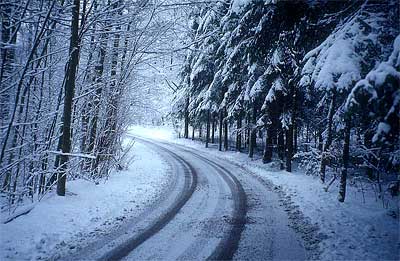
I do want to mention that we have a possibility for some snow flurries on Thursday into Friday for parts of Southern Ontario. An Alberta Clipper will pass through bringing cold air with it, thus making the conditions right for some of that white stuff we've all been waiting for. The map below best shows where these flurries could occur over the two day period.
 |
| Click to enlarge |
Frost!!!

On a brighter note, this Tuesday we will have a warming period for a short time as temperatures rise to the mid twenties. It will be short lived as cold air once again masquerades Southern Ontario on Wednesday.
Winter Forecast 2010 - 2011
It is August already, a time when the winter forecasts are starting to trickle out by brave meteorologists who take a long shot at predicting snowfall amounts for the next six months. No longer are you dealing with short term weather models used for thunderstorms, but now you are dealing with long range weather models that track storms from the Pacific Ocean - all the way to Southern Ontario. Such examples of this would be the GFS model, the most accurate and up to date weather model out there............just kidding! Even the GFS can have a lot of fun taking people on emotional roller coasters. This model will predict a winter storm two weeks ahead for Southern Ontario, and then suddenly show this winter storm as a coastal blizzard, leaving Southern Ontario storm chasers reeling in amusement, and most times anger from all the false anticipation. I could go on and on about the weather models, but I'll cut to the chase. I have three winter storm forecasts that I would like to show you today. The first one will be done by Joe Bastardi, a well respected meteorologist; the second one will be done by Brett Anderson, a meteorologist who specializes in Canadian weather climate; the third one will be done by me, a meteo....well we won't get into that. Please scroll down for each individual map:
Joe Bastardi's Storm Track

Brett Anderson's Storm Track


Joe Bastardi's Storm Track

Brett Anderson's Storm Track


My Storm Track
 |
If we look at the first map, you will see that Joe Bastardi has a pretty realistic idea of the upcoming winter. This is what he says, " The Canadian winter will be harsh as last year's was gentle." I agree with his idea of the 2010 - 2011 winter until it comes to his idea of snow for Washington DC and the surrounding areas. I think he has missed the possibility for some heavy snow in the Mid-Atlantic, which would be triggered by what we commonly know as the Alberta Clipper(see my map). Looking at history, an Alberta Clipper always intensifies after crossing the lower portion of the Great Lakes, and then sometimes increasingly intensifies after entering Virginia, due to warmer air from the south. If we look at the next three maps by Brett Anderson, which predict the months of December, January, and February, you can see that Brett agrees with all of us about an active storm track for the western great lakes. I, however, do not agree with his prediction of an active storm track to the east during the month of December. It is to my belief, that December will be dry to the east because La~Nina conditions (Cooling of Pacific Ocean) will still be very weak by then. He doesn't agree with that, and believes that La~Nina conditions will already be in full force before December starts. In regards to that, I should mention that El~Nino(Warming of the Pacific Ocean near the equatorial line) is expected to fully dissipate during the next month or two. I will sum it up with this, Southern Ontario will get some wet storms this year as we will be occasionally placed below the jetstream. Storms that start with rain, ice, and snow will not be uncommon for Southern Ontario this winter. The temperature will be above average for some of the regions in Southern Ontario, with a pretty large thaw taking place during middle to late January. The active storm track will stay west of Southern Ontario, with a few storms coming up along the east coast. Alberta Clippers will definitely not be uncommon for Southern Ontario, however the snow amounts will most likely stay below 10 - 15 centimeters. I would like to mention one more possibility that might take place during February and March 2011. If you noticed, I have the Alberta Clipper track further south then most meteorologists would have it. In my opinion, the La~Nina could strengthen considerably by February or March, causing the jet stream to dip further south. If that happens, Southern Ontario could see more Alberta Clippers and possible colder air. This would not change my snow predictions for Southern Ontario due to the fact that Alberta Clippers don't usually deliver large amounts of snow. A more indeph look at the winter forecast will take place closer towards the month of November. |

Blazing Heat

This week will be a week to remember for many Southern Ontario residents as we experience our first major heat wave. Temperatures will soar to the mid thirties for many regions as a high pressure system from the lower states drives warm air north. There is a chance for thunderstorms tomorrow as a weak cold front travels in an eastward direction over Southern Ontario. The chance of thunderstorms becoming severe is moderate, but it does not signal any comfortable temperatures for Southern Ontario. Warm air will yet again flood into Southern Ontario forcing humidity levels to rise and making the air very hard to breathe.
The comfortable temperatures might come this coming weekend, and I will post any information about that later as the time draws closer.
Heated Long Weekend Arriving

Today Environment Canada issued many severe thunderstorm watches in anticipation of an active afternoon and evening. The results were less than surprising as only a couple thunderstorms cells developed and quickly headed east. Interest started to peak when one of these cells started to show an increased development south of Barrie. The result of that storm alone was disappointing as it joined up with other storm cells and headed east on HWY 401 towards Kingston.
A new directed focus is on the Gulf of Mexico as tropical storm Alex displays itself as quite the powerful storm. Alex is expected to become a category one hurricane by Tuesday afternoon, and is expected to make landfall by the weekend. The track has been guessed and forecasted many times, but is still very unclear on what part of land it could hit. Early suggestions have placed the landfall of Alex near Corpus Christi, a city located close to the border of the United States and Mexico. Forecasters do believe that this tropical storm will be a category three hurricane before it slams into land.
A high pressure system will move into Southern Ontario this week giving way to some very sunny skies for Canada Day and the long weekend. Heat will move into Southern Ontario on Saturday, and there you will begin to see the humidity move in. This heat and humidity should last until Monday or Tuesday of next week, and during this time period, Ontario residents can expect temperatures in the low to mid thirties. More information will come to surface on any possible storms that could follow this heat wave.
Severe Weather Late Evening and Overnight

A line of thunderstorms in front of a powerful cold front will continue to travel towards Southern Ontario during the next 6 - 12 hours. These thunderstorms will be severe for areas south of a line starting at Owen Sound and ending in Oshawa. Heavy rainfall along with high winds, frequent lightning, and an isolated tornado cannot be ruled out. Please refer to any severe weather bulletins that Environment Canada may issue as these storms approach.

Mother Nature Teases Leamington With Wild Weather
UPDATE----Environment Canada has confirmed that an F1 tornado did touch down along the shore of Lake Erie, west of Leamington. This confirmation would account for some of the damage in or around the surrounding area of Leamington.
_____________________________________________________________________________________

Saturday night was a turbulent night for the small city of Leamington. When I saw the tornado warnings pop up for the area last night, I noticed with great interest that the city is on land that looks a bit like a tornado. It is south of Leamington where this part of Ontario juts into Lake Ontario giving us the shape of a tornado. I did not get a chance to head down there today to survey the damage, but I managed to read some of the reports and see some of the pictures. Below are some of the pictures:


The first picture was taken by Ron Nelson and the rest of the pictures were taken by Ben Nelms of the Windsor Star. We cannot assume that all the damage shown in the pictures above was the result of a tornado. Yes, tornado warnings were issued, but there were no confirmed tornado sightings. People say they heard the sound of a freight engine last night which is most commonly assumed to be a tornado, but in fact, a funnel cloud can make the same noise with wind and hail in the updraft. The other thing that could cause that noise, and also that kind of damage would be a downburst. This is what I believe could of been the cause to some of the damage there. In basic terms, a downburst is a strong sheet of wind that plummets down or is sucked in from the base or perhaps behind a thunderstorm. Nevertheless, downbursts are dangerous and should not be taken lightly. Below is a picture by Jeff Masters which gives you a good illustration of a downburst:

Now if you were to put this picture in front of the pictures of damage I have up above, we could see how this all could be the result of a downburst. I want to show you a picture of damage caused by a downburst in Northern Ontario:

Do you notice how the trees are bent down as if someone swept their hand through the forest? Do you see how most people might see this picture and assume it is a tornado?
Now the conclusion to the cause of damage in Leamington is still unknown, and it is something the Environment Canada team will have to figure out. I will release the results of their investigation later. Below is the statement Environment Canada has issued:
"AWCN11 CWTO 061336
Weather summary for all of Southern Ontario and
The national Capital region
Issued by Environment Canada Toronto
At 9:40 AM EDT Sunday 6 June 2010.
Southern Ontario thoroughly soaked
-------------------------------------------------------------
==weather event discussion==
An unseasonably strong low pressure system tracking across the lower
Great Lakes prompted several warnings to be issued for the Windsor
and Chatham areas including tornado and rainfall warnings.
Significant rainfall amounts were recorded throughout much of
Southern Ontario last night with amounts ranging from about 20 to
50 mm. The rain is expected to taper off this morning in
Southwestern Ontario and late this afternoon in Eastern Ontario.
Severe thunderstorms in the Windsor area left their mark on the area
with damage reports relayed from the OPP covering a swath from near
kingsville to Leamington. Environment Canada has sent out a damage
survey team to asses the impacts of last nights storms in the
Windsor to Leamington area
A list of rainfall amounts as of 8 AM appears below.
-------------------------------------------------------------
Date
Location rainfall amount (mm)
Windsor 52 mm
Harrow 40 mm
Ridgetown 51 mm
London 30 mm
Sarnia 23 mm
Goderich 31 mm
Delhi 35 mm
Welland 39 mm
Vineland 30 mm
Hamilton airport 38 mm
Hamilton (rbg) 26 mm
Toronto 21 mm
Please note that this summary contains the observations at
The time of broadcast and does not constitute an official
And final report of the weather events or the high
Impact events attributed to the weather events."
For those of you who live in Southwestern Ontario, you do not need to worry about severe weather again tonight. There is a chance of thunderstorms there tonight, however it will not be severe in nature.
_____________________________________________________________________________________

Saturday night was a turbulent night for the small city of Leamington. When I saw the tornado warnings pop up for the area last night, I noticed with great interest that the city is on land that looks a bit like a tornado. It is south of Leamington where this part of Ontario juts into Lake Ontario giving us the shape of a tornado. I did not get a chance to head down there today to survey the damage, but I managed to read some of the reports and see some of the pictures. Below are some of the pictures:

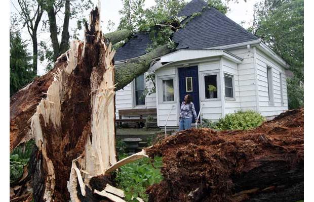


The first picture was taken by Ron Nelson and the rest of the pictures were taken by Ben Nelms of the Windsor Star. We cannot assume that all the damage shown in the pictures above was the result of a tornado. Yes, tornado warnings were issued, but there were no confirmed tornado sightings. People say they heard the sound of a freight engine last night which is most commonly assumed to be a tornado, but in fact, a funnel cloud can make the same noise with wind and hail in the updraft. The other thing that could cause that noise, and also that kind of damage would be a downburst. This is what I believe could of been the cause to some of the damage there. In basic terms, a downburst is a strong sheet of wind that plummets down or is sucked in from the base or perhaps behind a thunderstorm. Nevertheless, downbursts are dangerous and should not be taken lightly. Below is a picture by Jeff Masters which gives you a good illustration of a downburst:

Now if you were to put this picture in front of the pictures of damage I have up above, we could see how this all could be the result of a downburst. I want to show you a picture of damage caused by a downburst in Northern Ontario:

Do you notice how the trees are bent down as if someone swept their hand through the forest? Do you see how most people might see this picture and assume it is a tornado?
Now the conclusion to the cause of damage in Leamington is still unknown, and it is something the Environment Canada team will have to figure out. I will release the results of their investigation later. Below is the statement Environment Canada has issued:
"AWCN11 CWTO 061336
Weather summary for all of Southern Ontario and
The national Capital region
Issued by Environment Canada Toronto
At 9:40 AM EDT Sunday 6 June 2010.
Southern Ontario thoroughly soaked
-------------------------------------------------------------
==weather event discussion==
An unseasonably strong low pressure system tracking across the lower
Great Lakes prompted several warnings to be issued for the Windsor
and Chatham areas including tornado and rainfall warnings.
Significant rainfall amounts were recorded throughout much of
Southern Ontario last night with amounts ranging from about 20 to
50 mm. The rain is expected to taper off this morning in
Southwestern Ontario and late this afternoon in Eastern Ontario.
Severe thunderstorms in the Windsor area left their mark on the area
with damage reports relayed from the OPP covering a swath from near
kingsville to Leamington. Environment Canada has sent out a damage
survey team to asses the impacts of last nights storms in the
Windsor to Leamington area
A list of rainfall amounts as of 8 AM appears below.
-------------------------------------------------------------
Date
Location rainfall amount (mm)
Windsor 52 mm
Harrow 40 mm
Ridgetown 51 mm
London 30 mm
Sarnia 23 mm
Goderich 31 mm
Delhi 35 mm
Welland 39 mm
Vineland 30 mm
Hamilton airport 38 mm
Hamilton (rbg) 26 mm
Toronto 21 mm
Please note that this summary contains the observations at
The time of broadcast and does not constitute an official
And final report of the weather events or the high
Impact events attributed to the weather events."
For those of you who live in Southwestern Ontario, you do not need to worry about severe weather again tonight. There is a chance of thunderstorms there tonight, however it will not be severe in nature.
Here Comes the Warm Weather - Updated!

The picture above that contains a circled portion is most likely the place where Environment Canada spotted cloud rotation. At approximately 10:30pm Environment Canada issued the following warning:
"ENVIRONMENT CANADA HAS UPDATED A TORNADO WARNING FOR
SOUTHERN ONTARIO AT 10:35 PM EDT FRIDAY 4 JUNE 2010.
A SEVERE THUNDERSTORM WARNING IS CONTINUED FOR
WOODSTOCK - TILLSONBURG - OXFORD COUNTY.
A SEVERE THUNDERSTORM WARNING IS UPGRADED TO A TORNADO WARNING FOR
SIMCOE - DELHI - NORFOLK.
AT 10:20 PM EDT DOPPLER RADAR INDICATED A LINE OF SEVERE THUNDERSTORMS FROM NEAR CHATHAM TO WHEATLEY. THIS LINE OF SEVERE THUNDERSTORMS WAS MOVING TOWARD THE EAST AT 60 KM/H, AND WAS CAPABLE OF PRODUCING WIND GUSTS IN EXCESS OF 90 KM/H.
DOPPLER RADAR HAS INDICATED SOME WEAK ROTATION WITHIN THIS LINE. WHILE NOT IMMEDIATELY LIKELY, TORNADOES CANNOT BE RULED OUT WITH THIS LINE OF THUNDERSTORMS.
THIS IS A WARNING THAT SEVERE THUNDERSTORMS ARE IMMINENT OR OCCURRING IN THESE REGIONS. REMEMBER SOME SEVERE THUNDERSTORMS PRODUCE TORNADOES..LISTEN FOR UPDATED WARNINGS. EMERGENCY MANAGEMENT ONTARIO RECOMMENDS TAKING COVER IMMEDIATELY WHEN THREATENING WEATHER APPROACHES.
NOTE..A SUMMARY OF ALL WARNINGS AND WATCHES FOR SOUTHERN ONTARIO IS AVAILABLE IN THE WWCN11 CWTO BULLETIN ISSUED IMMEDIATELY FOLLOWING THIS BULLETIN."
Then close to 11:00pm Environment Canada extended this tornado warning to St. Thomas, Aylmer, and Eastern Elgin County. This tornado warning carried on until about 11:10pm when Environment Canada released the following statement:
"ENVIRONMENT CANADA HAS UPDATED A TORNADO WARNING FOR
SOUTHERN ONTARIO AT 11:10 PM EDT FRIDAY 4 JUNE 2010.
A TORNADO WARNING IS ENDED FOR
ST. THOMAS - AYLMER - EASTERN ELGIN COUNTY AND
SIMCOE - DELHI - NORFOLK.
TORNADOES HAVE DISSIPATED OR HAVE MOVED OUT OF THESE REGIONS.
A SEVERE THUNDERSTORM WARNING IS CONTINUED FOR
WOODSTOCK - TILLSONBURG - OXFORD COUNTY."
At this time there are no immediate reports of a tornado that actually touched down, however the night is still young and the area that any such tornado could have hit would be large and sparsely populated. Any reports of damage would be thoroughly investigated by Environment Canada to further determine whether a tornado did indeed touch down at the time that the cloud rotation moved through. Further information will be posted about this possible tornado as information becomes available through severe weather spotters and Environment Canada personnel.
-------------------------------------------------------------------------------------

I have the scoop for the future weather in Southern Ontario! The next week and a half in Southern Ontario will show moderate temperatures periodically rising above 25 degrees, but more than likely ending up slightly below the 25 mark. Once we complete the next week and a half, then we will then get a chance for some really warm weather stretching all the way into the beginning of July. In fact, the last week of June could show temperatures ranging in the mid thirties. This information is taken from several long range weather models and therefore can be presumed to be about 85% accurate! Stay tune for further details.
I also wanted to mention the possibility of thunderstorms in Southern Ontario the next few days. The atmosphere has been a bit unstable the past few days, and can be expected to continue in its instability. Pop up thunderstorms will not be uncommon within the next few days. Hail up to 2 centimeters along with winds up to 90 kilometers will be the main threat along with these storms. Heavy downpours are also a possibility with rainfall amounts at times exceeding 25 millimeters in one hour. Please keep an eye on the map to the left for all the latest weather watches and warnings.
Monday Storm Chase!

Today I got a chance to chase some severe storms that struck areas north and east of Dundalk. On my way home from work, you could just feel in the air that we could be getting thunderstorms. At home, I setup the radar screens and started following the thunderstorm activity on the map. One storm originated from Windsor and headed towards Toronto, only to dissipate into showers. Another storm started over Orangeville and headed northeast towards Alliston. While that storm was forming, I noticed a band of storms that was currently crossing the south end of Lake Huron. These storms were heading north and twenty minutes later, ended up just west of Mt. Forest. I had a choice, I could chase the storm going towards Alliston, or I could chase the one just west of Mt. Forest. Both storms would take me miles apart from each other, so the decision would have to based on what storm I thought had most potential. I decided that I would stop for gas before I made this decision, and as far as I was concerned, there was no use of rushing into this. Having said that, the decision would have to be made within the next twenty minutes considering the storms would continue their northeast track with or without me. I purchased gas and checked the maps in my car again, only to see that the storm,(now located over Alliston) had lost considerable strength. The other storm, (now slightly north of Dundalk) had strengthened and become quite severe in nature. The decision was now easy for me to make. I was currently 45 minutes away from the Dundalk storm, so I started my car and hit the road with a little urgency, considering I now had to catch up with it.

I took County Road 124 in hopes that I could get east of this rapidly growing storm. My plan was to place myself in a strategic area where this storm would sweep over County Road 124 in the area I was parked. The picture above is me traveling down County Road 124, approaching the storm from the south. You can see the sky north of me begin to darken as I approach. Five minutes more of traveling, I pulled over to the side and took down my antennas. There was no point in creating lightning sticks by keeping my antennas on my car. I continued on towards my desired position and started to encounter heavy torrential rain. There were times that I could not even see the car in front of me. I eventually got out of the torrential rain and positioned myself in an area that would place me directly in front of the approaching storm.

My location was excellent because I got to see the leading edge of the storm before I experienced the inside of the storm. I sat in a church parking lot along County Road 124 and saw the area to the north where hail was falling. You could see the hail fall, and it reminded me of a white solid sheet reaching from the sky and touching the land. A little east of this moving hail was some various cloud formations which at times seemed to spin. At one point, I believed a funnel cloud was in the midst of forming, but I knew it could not be the case after it broke up a few minutes later. I stayed in that position for the next fifteen minutes before I continued on with my track. I had to get away from the rain, because it was limiting my visibility considerably. Southern Ontario storms consist of a lot of precipitation, compared to the dry storms in Michigan and further south of there. Now because of this, it makes it very hard to spot out certain cloud formations in the storm. If I stay ahead, behind, or on the side of the storm, then blinding rain will no longer be an issue.
The next two pictures are part of an interesting little encounter I had:


The first picture was of me just exiting Elmvale approaching the severe part of the storm again. A few moments later this road would lead me into a forest. During this time, it seemed as if the lightning was picking up again. Before I knew it, I saw a quick flash towards my left and heard an ear splitting sound of a tree being sliced in half. It was quite interesting considering I have never seen lightning strike so close, and with such powerful magnitude. I finally gave up chasing at Orr Lake sometime around 10pm and started my travel home, away from all the severe storms. While chasing this storm, Environment Canada issued severe thunderstorm warnings in all the areas I was in tonight. Even when I left to head home, they were still issuing warnings north of Elmvale, as the storm continued northeast. Overall it was a good storm chase tonight. I did not expect these thunderstorms to maintain their intensity as they continued north. I guess weather will continue to throw out little surprises here and there.
Thunderstorms to Dominate Southern Ontario Monday!

It has been awhile since I have updated this blog, and I sincerely regret it. A lot of severe weather has taken place, and a lot more will continue to take place as the hot summer weather plows on. First off, I would like to express my deepest regrets in regards to the passing away of Paul Chantree. Paul Chantree tirelessly spent hours working actively in ARES (Amateur Radio Emergency Services). Environment Canada has released a statement honoring Paul for his outstanding work in Dufferin County:

"On a sadder note, CANWARN and Amateur Radio lost an energetic and tireless supporter with the passing earlier this month of Paul Chantree. Paul was a strong proponent of public safety initiatives and was an integral part of the Dufferin County CANWARN group since it's inception a number of years ago. He was well-known to a number of Environment Canada staff including CANWARN's founder Randy Mawson and Phil Chadwick, meteorologist and a dynamic CANWARN trainer for a number of years. He will be greatly missed and on behalf of everyone here at Environment Canada I wanted to express my deepest condolences to his widow, Rita.
Regards,
Geoff Coulson
Warning Preparedness Meteorologist |
Météorologue de sensibilisation aux conditions menaçantes
Ontario Region Client Services |
Service à la clientèle, Région de l'Ontario
Environment Canada | Environnement Canada
Goverment of Canada | Gouvernement du Canada
4905 Dufferin St | 4905 rue Dufferin
Toronto, ON M3H 5T4
Geoff.Coulson@ec.gc.ca
Telephone | Téléphone 416-739-4466
Facsimile | Télécopieur 416-739-4603
Website | Site Web www.weatheroffice.gc.ca"
I had the opportunity this year of attending two Canwarn (Canadian Weather Amateur Radio Network) sessions, where during our initial session in Toronto, we experienced our first line of summer thunderstorms, rumble over our heads, sweep across Southern Ontario, and start pagers beeping from all the weather statements issued by Environment Canada. These storms were not severe, but made our session a little more realistic and appropriate in terms of what we were going to learn. It also got us wishing we had taken our umbrellas with us. (What can you expect though! We're storm chasers; we take antennas, not umbrellas.) The second session was held in Grand Valley last week Tuesday where we heard a little more about the devastating 1985 tornado that ended up killing four people in Dufferin County. An interesting fact about this tornado was the fact that the power had gone out in an industrial park hours before the tornado stuck. As a result, many factory workers were able to go home early, avoiding a catastrophic death. More information about this tornado can be read at: http://www.orangeville.com/news/local/article/820660--25-years-later
Last Thursday a line of thunderstorms swept through Southern Ontario. As a result, Environment Canada issued severe thunderstorm warnings in several regions, including Newmarket. Newmarket ended up receiving hail along with some reports of 90km winds. Hail was also reported in Hamilton and Brampton.
On Monday we will get the same type of weather that we experienced last Thursday. If you look at the radar picture located below this post, you can see a line of thunderstorms currently centered in Wisconsin, slowly heading over to Michigan. This line will continue to move in a westward direction, and will eventually reach Southern Ontario by mid-day tomorrow. Some of these storms will become severe due to daytime heating and humidity. Localized hail, (up to the size of a nickel) and 100km wind gusts could take place in some of these storms. Please keep checking back with Environment Canada to make sure you are not caught unprepared in any of these storms. Severe thunderstorm watches and warnings may have to be issued as these storms come closer.
Storm Snow Predictions

The storm that was forecasted to give blizzard conditions has weakened slightly for areas east of Lake Ontario and Lake Erie. This is precisely why I have issued a new snowfall map. This storm will wind down sometime tomorrow morning.
A new weather pattern is setting up. This new weather pattern will bring snow back to Southern Ontario and the surrounding regions. My general estimation would be that we will experience a pattern that could pull in a Colorado Low for Southern Ontario. I find it highly irregular for Accuweather to take a stance on the idea of winter storms starting to wane for the season. I nor the weather models have seemed to adopt this preposterous idea. The next chance for a storm in Southern Ontario will be somewhere from March 5 - March 7, 2010.
Blizzard 2010!!!

My biggest pet peeve use to be when other meteorologists always hyped up storms. It was frusterating when they called for 6 - 12 inches of snow and then only 3 inches of snow actually fell. I never realized until now, how difficult their job actually is. This storm is one very difficult storm to predict. The good news is that the weather models are showing some consistency in where the storm is going to go. I am certain that the track is going to be exact or similar to the one I have on the map. The storm hits the coast and moves inland in a southwestward direction. Then it stops unleashes its power inland creating heavy winds and blinding snow. As it loses its intensity, it will start to move northward again.
Now how will this storm affect Southern Ontario? The temperatures need to be factored in before I give accurate snowfall predictions. Most regions in Southern Ontario will receive a mix of rain and snow with the majority as snow. Other regions will just receive snow flat out. Deciphering this snow/rain line will be hard indeed. I believe that the only areas to receive a possible blizzard in Southern Ontario is the Niagara Falls area and maybe a bit of Toronto. All other areas will receive slightly less heavy winds and of course, heavy snow in the 6 - 12 inch range. The blizzard areas I mentioned will pick up 12 - 24 inches of snow. I will keep an eye on this storm and will inform you of the latest developments.
Just a quick note,
The Cornwall area is under a snowfall warning until late tonight as a heavy snowband has set up in the area giving 15 centimeters of snow.
Snowstorm for Southern Ontario Later This Week?

A low currently in the southern states will continue its trek around the country and will eventually hit a soon to be stationary low that will hover around the east coast. The collision of these two lows could create a blizzard for parts of the United States and also parts of Southern Ontario. One of the factors that can stop a potential blizzard from occurring is warm temperatures. This could very well happen in the area I circled as blizzard. Even with the temperature possibility in the area I circled, we can be sure that the area around the circle labeled as heavy snow will not be affected by a temperature change and therefore could easily see 6 - 15 inches of snow. It is still premature for me to hand out snowfall accumulations so please keep checking back for future updates. The time frame for this potential blizzard/winter storm will be from Thursday - Saturday.
The second thing I just briefly want to touch on is the storm currently affecting Southern Ontario. Bursts of heavy snow are affecting Southern Ontario at this moment and will continue to do so until late tonight and Tuesday morning. Please check the previous post for snow accumulation predictions.
Subscribe to:
Posts (Atom)